Two major pilgrimage footpaths cross the Pays Voironnais: the road to Santiago de Compostela and the Via Sancti Martini, here is an opportunity to rediscover the territory in a different way!
The road to Santiago de Compostela in the Pays Voironnais
Things to know on the way to Santiago de Compostela
Thousands of pilgrims set off each year on the Camino de Compostela with the aim of reaching the famous Cathedral of Santiago de Compostela. The believing Catholics of the time came to pray on the relics attributed to the apostle Saint-Jacques, today this pilgrimage is also a moment of exchange, sharing, a spiritual journey to recharge one's batteries.
The itinerary with us
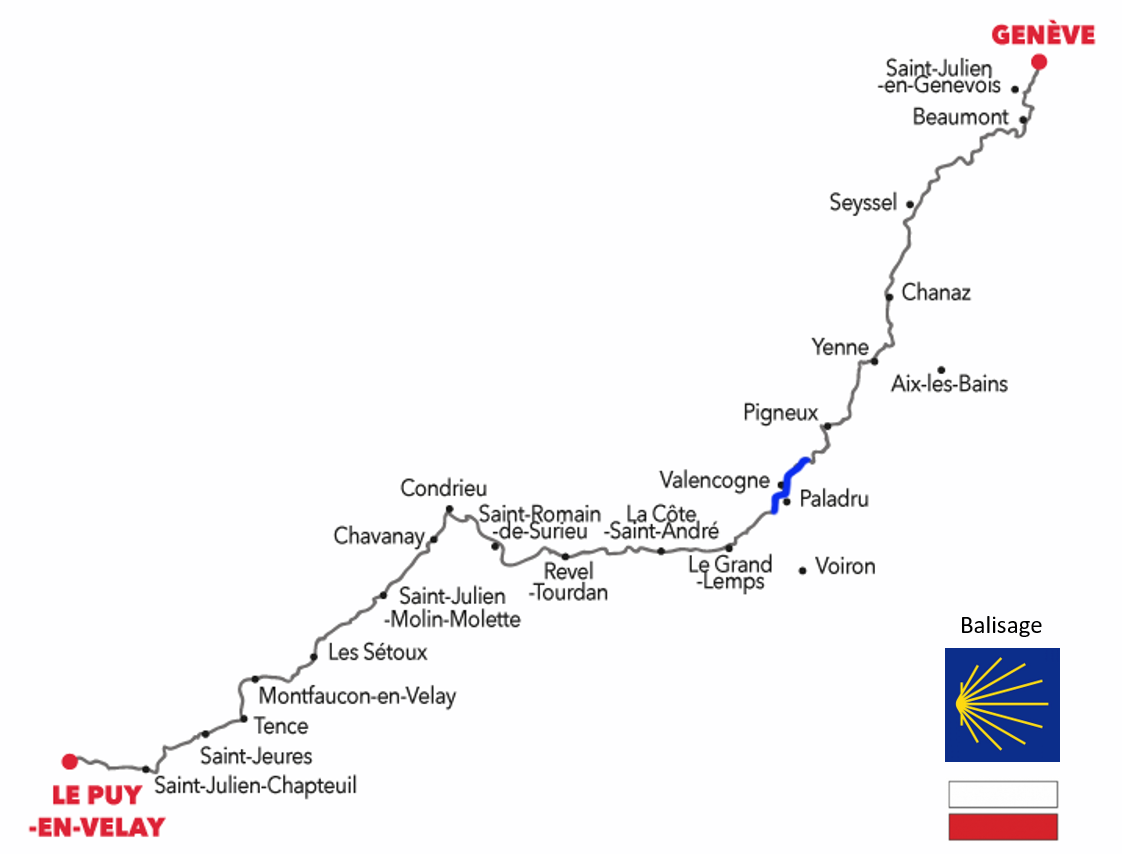
From Geneva, the portion of the road to Santiago de Compostela which joins the Voie du Puy-en-Velay (GR65), is 360 km and can be covered in 18 days. Part of this journey crosses the Pays Voironnais from north to south for 24km crisscrossing the hills between the municipalities of Abrets and Oyeu and passing near Lake Paladru.
The route map
Between Geneva and Le Puy-en-Velay, the portion crossing the Pays Voironnais is drawn in blue. The signposting of the Compostela path is marked by a yellow shell on a blue background, in Pays Voironnais you can also follow the markup of the GR (white and red) which takes the same route.

Source: Puy-en-Velay tourist office
The Via Sancti Martini in the Pays Voironnais
Things to know about Via Sancti Martini
The Via Sancti Martini follows in the footsteps of Saint Martin who was a great traveler and universal figure of sharing in the 6th century. It connects, in 2500 km, the birthplace of Saint-Martin in Hungary, to French Touraine where his tomb is located.
The itinerary with us
From landscapes populated by mountains and valleys to the small hamlets typical of the region, you will travel through the Country of Art and History of the Pays Voironnais, recognized internationally for its remains of Neolithic and medieval villages on the shores of Lake Paladru.
The route based on the values of sharing and exchange is an opportunity to discover the heritage, local products, the know-how of the territory, by promoting rich and friendly encounters.
The route map
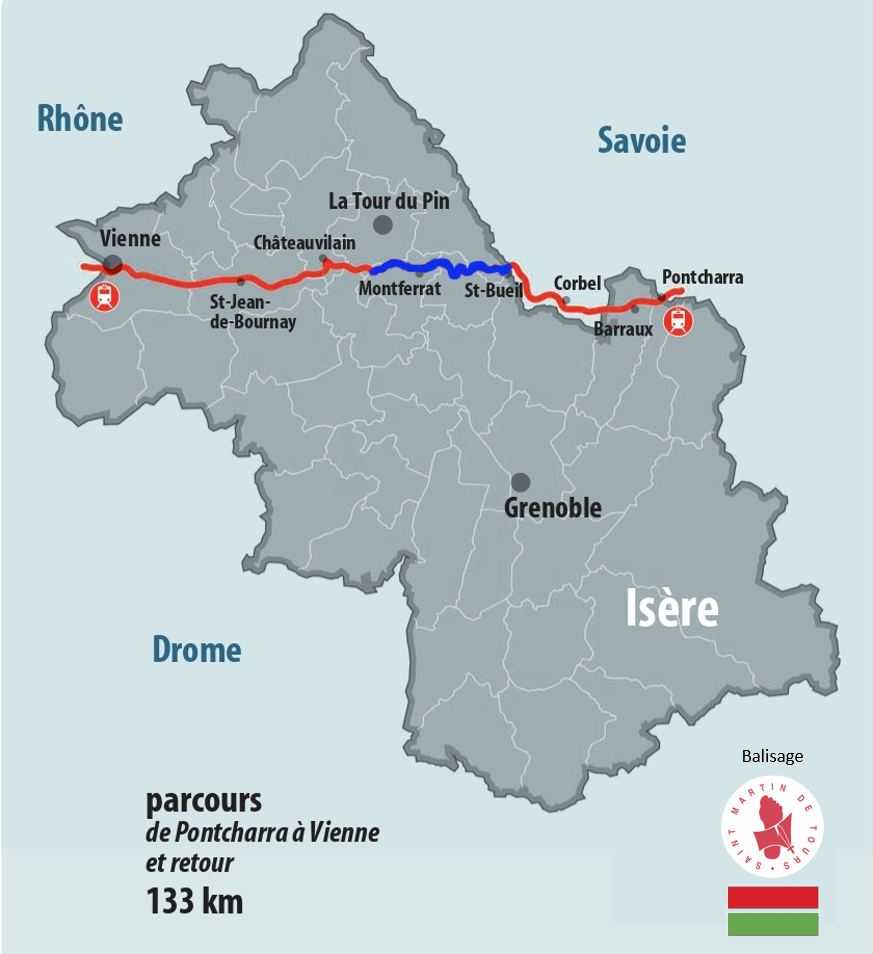
Between Pontcharra and Vienne, the portion crossing the Pays Voironnais is drawn in blue. The waymarking of the Via Sancti Martini is marked by two lines of red and green paint or by the step of Saint-Martin which symbolizes the gesture of sharing.

Source: Christophe Bonté, Régine Bordeau, Hubert Morel


